Wednesday, June 29, 2022

Independence Days

 July 3, 2002- Wednesday

Missoula, MT to Seeley Lake, MT


The Missoula airport was small and designed in a hunting lodge style that welcomed visitors to the ruggedness of Montana. There were virtually no lines at check-in or security, and after a perfunctory trip through the gift shop, Brian and I hugged goodbye for the couple of days he would be away at a wedding. The kitties and I did not stick around to watch the plane leave; we had plans of our own. 


Backtracking a few miles up into the Rockies, I pointed Herb north along a scenic route that took us to the town of Seeley Lake, my Fourth of July destination. The gas station, gift shops and outdoor store of Seeley Lake clung to both sides of the narrow highway amid tall pines. At the far end of town I claimed my reserved room at the Seeley Lake Motor Lodge. Kathy, who recently became owner of the motor with her husband Bob, gave me the keys to unit #3, admired Herb and told me the kitties were welcome for a few extra dollars. It was so hot outside and so cool in the room that I gladly paid their way.


Leaving the cats in comfort, I explored the shops on both sides of the street. There were lots of cute black bear and moose gifts, mountain crafts and Native American handiwork, but I was not in the mood for souvenirs. I was, however, in the mood for a root beer float and the one I got at the old fashioned soda fountain really hit the spot on a hot, dusty day. 


The only other thing I bought was a little gift for Brian- a thin nylon cord with clips on each end designed to attach to the back of a cap and to your collar to keep your hat from blowing away. Brian phoned me in  the evening, but I kept his present a surprise. 


 July 4, 2002- Thursday

Seeley Lake, MT


A nearby lakefront campground and park with tall evergreens provided a cool place for the kitties and me to spend Fourth of July morning. I took it easy and conserved my strength for the midday parade. Back in Seeley Lake, Herb and the cats remained at the motel as I hung the video camera around my neck and walked one block to the center of town, positioning myself to capture parade highlights on tape. People dressed in red, white and blue lined both sides of the sunny street and I was actually grateful for the sliver of shade from a lamppost at my back. 


The parade started with a small, eagerly welcomed color guard, and close on its heels began the tossing of candy to kids in the crowd. Candy throwing was a theme throughout the parade- antique fire engine, candy, pony cart, candy, Shriners in little yellow midget cars, more candy. My favorite of course, was the 14 piece community band which rode on a flatbed trailer. The finished America the Beautiful as they reached me and started on You’re a Grand Ol’ Flag. That gave me a nostalgic lump in my throat as I thought back on my many years of playing in Fourth of July parades. Seeley Lake put on a good long parade which wound up after floats, classic cars bearing dignitaries and lots more candy. 


As soon as the last car passed, I made a beeline across the street to the soda fountain, beating the milling crowd to root beer float number two in two days. This time I even videoed my decadent treat. Refreshed, I retired to my un-air-conditioned yet cool motel room and worked on the computer until the banging and cracking outside enticed me to watch locals lighting some very sophisticated fireworks and rockets in the parking lot. The big fireworks began after dark and I walked to a restaurant that shared its lakefront lawn with crowds of onlookers. A spectacular display of pyrotechnics ended a festive Independence Day. 


004 Great Falls

 June 30, 2002

Near Glacier National Park to Many Glacier Campground


It was a short trip north from our overnight turnout back to Glacier National Park and the Many Glacier Campground. We chose a shady space although there was little concern of heat with the overcast skies. We had experienced the park from the car on our spectacular drive yesterday and now we had a hankering for some exploration by foot. A number of trails began at the campground, and we selected Swiftcurrent Pass Trail, a path that headed right up into the towering mountains. I wore a belt pack with camera, binoculars, snacks and water, while Brian took a knapsack containing raincoats, compass and small foam sitting pads. With sturdy shoes laced up tightly and hats snugged down firmly we felt prepared for whatever lay ahead. 


The trail took off on the level through thin trees and over a creek.  Gradually, it began to climb but the single-file pathway was smooth and footing was good. It was fortunate that we did not have to watch our feet too closely because the view was already spectacular. Glacier action tends to produce wide curved valleys with sheer mountain faces and we marveled at the peaks beside us, across the valley and up farther in the ravine. We had been told to keep a lookout for wild mountain goats and longhorn sheep so we made an occasional pass with the binoculars. I got a good close-up view of some likely looking boulders but none of them had legs or heads, so we kept moving. 


It began to sprinkle, then to rain but we donned Gore-Tex jackets and proceeded undaunted. From time to time we stepped aside to let folks who were headed down the trail go by. We also let some people pass who were headed up the trail; did I mention how the altitude takes your breath away? The rain let up and at one particularly nice viewpoint we sat on a boulder and nibbled raisins and peanuts.  We had hiked a couple of miles and had nearly reached the line where stunted trees gave way to rocky meadows. After the break we climbed another mile or two before deciding we would probable want the rest of our energy for hiking back down the trail.  We had gone about four miles up and I do not know if I felt more intrepid or tired by the time we had completed the eight-mile round trip. There was an exhilarating moment near the end, though, when two people with binoculars pointed out a pair of bighorn sheep grazing in a meadow high above us. Brian and I took turns admiring the majestic creatures, grateful to have experienced another element of Glacier. 


Back at the campground we gathered our shower gear, purchased special shower tokens at the nearby store and washed away our weariness. Then as Brian fixed dinner over the campfire, I frowned at some suspicious looking dull white flecks on a mountainside. Just to confirm that I had spotted more wild boulders,  I retrieved the binoculars and looked again. Into focus came two big mountain goats and a small, lovely kid. It was a perfect ending to the day.


July 1, 2002

Glacier National Park, MT to Great Falls, MT


We said goodbye to Glacier National Park on a rainy morning that even clobbered us with some hail. Driving through the aspens we were able to add one more large animal sighting to our list of sheep and goat. Among the slender trunks stood a young moose, big and knobby, but clearly not full grown. We would have gone to the East Glacier entrance to see another historic lodge but the highway was closed. No matter; we decided to drive the 123 miles from Browning to Great Falls, and I took the wheel to give Brian a break. Off we set with 50 miles worth of gas in the tank. As the landscape turned abruptly into prairie, it dawned on me that putting a little more petrol in the bus might not have been a bad idea. The road rose and fell gently, and as we crested each hill I looked in vain for a town. There was only wide open prairie with the occasional ranch house. Very occasional. Now I started to become concerned and I checked the odometer to see how near we were to our estimated mileage for the next fill up (The gas gauge has never worked, so we go by mileage).  360 was when were due for gas and I watched the numbers roll over to 320... 330... 340... At 352 we hit the tiny one-pump town of Dupuyer and we almost did not see the station until we spotted a sign that said, “No Parking- gas pump”. We praised our good fortune and filled the tank.


Another town called Choteau popped up before Great Falls, this one with a more touristy feel and a helpful visitor information center. We picked up a brochure about the Charles M. Russell Museum, which we knew about, but also one for the Lewis and Clark Interpretive Center, an attraction which happened to be free with our Golden Eagle Pass. Immediately upon our arrival in Great Falls, we found the Lewis and Clark exhibit and took a self guided tour through their journey. The museum was laid out in sequence and we traced their trail, with brown carpet indicating travel by land and blue meaning by water. The left-hand wall told the explorers’ tale while the right explained the concurrent Native American story. The main feature was a depiction of the 19 mile portage around the Great Falls of the Missouri River at (of course) the current location of Great Falls. They built axles and wheels to put under their boats and made multiple tough, scrambly trips to move all the gear. We were sympathetically exhausted by the time we reached the gift shop.


The journey left us hungry, too, and we found a Wendy’s to put more of our gift Bucks to use. Then we slept off our toils at a Wal-Mart lot.

003 Glacier National Park

 June 25, 2002 – Tuesday

Baker City, OR to Joseph, OR


Happy Birthday to me!  We treated ourselves to morning lattes and pastries at a local, non-chain shop where the fan blew such cool air that I was too cold.  (I asked Brian to remind me later in the day when it got hot that I had ever been too cool.)  We made it to the Oregon Trail Interpretive Center exactly when it opened at 9:00 and bought a Golden Eagle pass to stick on our National Parks pass.  The Golden Eagle cost us $15 and saved us $10 immediately so it should pay for itself at other Forest Service fee sights.


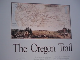
I handed Brian the video camera since I usually get to film while he drives and we began our visit at a circle of representative wagons on the top of the hill.  Below there was a real, live western cattle drive taking place and we captured it on video.  The center itself was arranged so you would walk past displays that progressed as the Oregon Trail did, from its beginning in St Louis to this site in Baker City and beyond.  The hardship and sacrifices of the more than 10,000 pioneers who rode and walked the trail was unbelievable, and many did not survive; there was a grave an average of every 80 yards along the trail.  It was all so moving that I had to buy another pin (and of course it is my birthday).


Birthday lunch was another Wendy’s treat in La Grande after we had gone north through grassy flatland that was bounded on the northeast by the snowy Wallowa Mountains and the west by the Blue Mountains and Elkhorn Range, with rolling sagebrush foothills.  The day grew hotter and hotter and by the time we reached Joseph, all we wanted was some shade for the cats.  We found a spot by a creek on a side street in town and immediately wet down the kitties.  They did not care for the process but appreciated the results.  I appreciated a wade in the creek!


Leaving Herb in the shade, Brian and I took a brief, boiling hot walk through Joseph, managing to admire the bronze statues and even shop in a music store for a plastic egg shaker (for Brian) and a pocket-sized tin whistle tune book for me (did I mention that it was my birthday?).  Finally we collapsed with tall iced lattes in our sweaty hands.


We decided to splurge on an actual camping space at Wallowa Lake and it bought us shade trees, visiting deer and free showers!  What bliss – we each managed to squeeze in two showers during the 18 or so hours that we were there.  For birthday dinner Brian fixed me garlic cashew ramen noodles with sautéed veggies and we uncorked a bon-voyage bottle of Gewurz from Ashland friends, Butch and Marsha McBaine.  Brian had hiked to the nearby convenience store for ice to chill the wine, fancy mixed nuts for appetizer and a fluffy, cool Jell-O dessert.


After our feast we strolled to the lake, which was peaceful in the early evening.  We skipped a few stones before turning in.


June 28, 2002 – Friday

Clark Fork River, ID to Kalispell, MT 

Waking to the sight of squashed mosquitoes on Herb, we reviewed our welts then made breakfast.  This time I cooked.  I invented a little something I like to call stovetop cinnamon rolls out of lightly fried white bread chunks with a topping of brown sugar, raisins, butter and cinnamon.  Tasty but rich.  It needed the coffee along with it.


On we went on the Scenic Pend Orielle Byway and in about three minutes we entered Montana and the Mountain time zone.  A few clouds filtered the penetrating sun as we wound along the river road.  Pine trees were all around, then there would be a sudden grassy field dotted with cattle.  This continued as we reached the town of Thompson Falls and made a gas and groceries stop.  Mountains now drew nearer and we began to ascend among the jagged, tilting slabs.  The climbing suddenly ended and we found ourselves in a high, fertile valley with ranches of cattle, buffalo and even one with the most llamas I have ever seen – hundreds in all sizes and colors.  From here we caught our first glimpse of the Rocky Mountains, pale blue and featureless in the distance.  


The land of fishing made us crave a little fillet of fish, but nothing local could be found so we settled for snapper.  This called for a special dining location and we were pleased to find the West Shore State Park on Flathead Lake.  The day use area provided a nice spot right next to the lake and we settled in for the afternoon – Herb’s side door was opened and the cats harnessed for safety, the pots and pans and cooking miscellaneous were assembled and Brian worked his cooking magic.  At our own folding table and chairs a nice meal of pan-fried snapper was served with accompanying wild mushroom cous cous and bon voyage chardonnay from Owen and Roxanne Jones, more friends in Ashland.  The tasty food, the fresh air and the lovely lake view all put us in a fine mood and I may perhaps have uttered a giggle or two.


The campground host paid us a visit and told us that he and his wife would be caring for the park all summer.  Then in past years they had been off to Arizona (with side trips to Mexico for fishing and food and sneaky beer margaritas) to while away the cool months before returning to Montana.  This year, though, his wife had decided they should buy a house and stay put.  He mumbled something about putting down roots but it was clear that he had his doubts about skipping the snowbird routine.  I told him we would give his regards to Arizona.


The “Big Sky” of Montana was touched with puffy clouds and wispy streaks, for which we were grateful.  We drove through the evening with the goal of reaching Kalispell in time to find a laundromat.  Kalispell was a pleasant city with a broad Main Street and a variety of stores blending the useful with a touch of the resort town feel.  We cruised the evening streets past shops and fairgrounds until we stumbled upon a laundromat that would be open until 11:00 – just long enough for us to wash and dry a load.  We half watched TV while the clothes de-filthed, and finding two quarters gave us an excuse to buy a soda from the vending machine.  About a block from the laundromat we parked on a quiet city street for the night.


June 29, 2002 – Saturday

Kalispell, MT to east of Glacier National Park


This was a red letter day, and not just because I had a maple bar with my coffee when we stopped between Kalispell and Glacier National Park.  Glacier is a place for which the word “wow” must have been invented.


I was one eager puppy as we reached the Apgar entrance to the park and flashed our brand new National Parks pass.  First stop was the visitor center on Lake MacDonald and we dutifully looked at the huge topographic map before walking over to see the lake.  The lake is beautiful, as mountain lakes usually are, but the backdrop of curved slopes soaring up to mountain peaks made it spectacular.  What surprised me was that even on a Saturday in the summer, we were entirely alone at the end of the boat dock for the time we were admiring the scenery.  Not that other people were not nearby, but it was definitely uncrowded.  Part of the explanation could have been the notice we read in the newspaper at the maple bar coffee shop that the famous Going-to-the-Sun Road through the park had only opened yesterday due to late snow.  We felt very lucky.


With video camera at the ready and in spite of occasional drizzle, we hit the scenic road.  First stop along the way was the historic 1913 Lake McDonald Lodge.  Its wood-beamed interior rose many floors at the center of the lobby area and animals looked down on us through glass eyes – bighorn sheep, moose, cougar, elk, mountain goat, bear.  At one side of the main floor was a huge stone fireplace and lounge chairs.  Hanging in the center of the lodge was a branching light whose many shades looked like parchment painted with Native American pictographs.  For a wooden lodge, the interior was surprisingly bright.


Back in the parking lot, we spotted another of the old red tour buses we had seen earlier, then another and another.  There seems to be an entire fleet of these restored 1932 vehicles still used and they add a charmingly nostalgic look to the park.


Unsure what to expect but ready to be amazed, we took off up the Going-to-the-Sun Road.  It warmed us up gradually with view of the mountains and river, but as we entered those mountains the scenery became truly spectacular.  I uttered repeated wows between warnings to Brian not to drive off the edge.  The old video camera got a workout as we ascended the carved mountains above green valleys.  The sky was wispy and it felt like we were climbing right into the clouds.  There was a fairly steady stream of cars but we all moved at a sensible gawking pace.  We took advantage of some of the turnouts to savor the view.  Koko seemed to appreciate the wonder of the situation and sat on my lap peering out at the peaks and abyss.  


Eventually, as expected the snow began to rise at the sides of the road until we were passing through walls of white.  As did most people, we turned out at the visitor center  on top of the pass, but it was closed and the bluster unnerved all but a few snowboarders.  Down, down we went on the Eastern side, buffeted by the wind, bewildered by the view.  When we reached the St Mary’s visitor center on the eastern edge of the park, we got out and stretched our legs (inside; it was too windy out of doors).  The spirit of the moment moved us to purchase a small, full-color booklet about the building of the road we had just driven.  And, of course, we picked out a pin for my growing collection.  It pictured a yellow Glacier Lily, which I had not seen but the design was pleasing.


Saving our camping bucks for the next day, we pulled into a roadside turnout just south of the park entrance and made camp.  There near the car was a patch of Glacier Lilies.


Section 1: Our Oregon Trail


The official BusRoads Bon Voyage party spearheaded by Mom was hosted at the Mountain Meadows Clubhouse today.  Present were Mom, Dad, Matt, Mary, Chris, Jennie, Owen & Roxanne Jones, Butch & Marsha McBaine, Barbara Wight, Adaire Moore, Mom’s friend Jan, Dick & Mary Mastain, Dave Campbell, Virginia Westerfield, Irene Harris, Sean McCoy, Julian & Connie Battaile, and last but not least, Theresa.  (Apologies to those I might have forgotten.)  Some brought gifts, most toured Herb, many were envious and some in disbelief.  But all were genuinely pleased for us and delighted to have been invited to the gathering.  It was nice to get together outside of a wedding or funeral.


June 23, 2002 – Sunday

Ashland, OR to Prineville, OR


It took rather longer to depart today than I had imagined, partly due to a very welcome visit from my Aunt Mary, who had gotten a flat tire on the way to the party yesterday, as well as her son Bruce and his wife Jo.  Bruce is knowledgeable about western Montana, having pulled fish out of the idyllic rivers with colleagues on several occasions.  He told us of a trip up to the Big Hole to visit the battlefield where Chief Joseph and his band of Nez Perce men, women and children escaped soldiers during one of the attempts to capture them during the legendary pursuit.  Bruce figures Chief Joseph was a heck of a guy.


The party map was pulled out of the garage for their visit and we poured over it together.  They were so sorry to have missed the party but our visit was much more intimate this way.


Packing of Herb took longer than I expected, too, but eventually Brian had the folding table and two chairs, a couple of large zippered bags, two small stuff sacks and various small pieces stored in Little Bob (our Thule top-carrier that looks like a bobsled) and I shoved the rest though Herb’s back door.  Cat box, water dish, food dispenser, scratching pad and miscellaneous kitty supplies were loaded, then video footage was filmed of the VW bus pulling away from the curb (actually just around to the front door).  Two big cats were located and said their farewells to “Grandma and Grandpa”, then hugs and goodbyes were shared all around.


It was about noon when we took to the road on Day One of the big adventure and everything began normally – Koko puked, Murph yowled and I got the customary lump in my throat from saying goodbye to Mom and Dad.  Apart from that, it was difficult to believe that more than a year would go by before we saw Oregon again so it was hard to feel too nostalgic.  We cruised north on I-5 – one of the few times we expect to resort to Interstate Highways – through the valley’s already dry fields and green orchards, past the Medford Manor (my brother, Matt, is not at work today), to the north exit and Crater Lake Highway.  It’s a sunny one and as the drive progresses I gradually have fewer sights to point out to Brian – here’s my grandparents old street, this is the turn we took when I went to scout camp at Lake of the Woods – and I grew silent as we curved past Mt. McLaughlin.


Tall firs began to hug the road and we passed meandering creeks that spilled into the rushing Rogue River.  No stop was planned at Crater Lake and we opted to cut to the west, then north of the national park.  Forests alternated with lush meadows and we were on a scenic uphill grade when Herb broke into a rattling blare.  Having just passed a paved turnout, we stopped and backed into a rare bit of shade to diagnose the problem.  Unplanned adventure number one, I thought, relieved that we at least had a patch of shade for our stay of who-knew-how-long.  Brian quickly figured out that a spark plug wire was not only loose, the entire plug had gone missing!  I patrolled the nearby highway for the part, trying hard not to focus on the multicolored pumice that lay everywhere.  Before I got far, Brian whistled; the plug had remained in the engine compartment.  Feeling that all would soon be well, I could concentrate on gathering pink and cream and white featherweight rocks to capture on film.  Hard as it will be, I will not be picking up rocks to carry around with us for a year (except maybe diamonds in Arkansas…).


Back on the highway we drove through high meadows of scarlet, pink and purple wildflowers.  Suddenly the unbelievably pointed shape of a mountain appeared, a ridiculous spire that seemed almost unnatural.  It turned out to be Mt. Thielson and it was the first vision on our journey that made me chuckle with disbelief.


As we neared Bend, we picked out a few familiar sights from a summer vacation a couple of years ago – the exit for Sunriver, the High Desert Museum, the signs for the lava tubes.  Hot and hungry, we found ourselves at a Wendy’s, eager to take advantage of the Wendy’s Bucks from Ashland friends, the Mastains.  Picking carefully from the 99-cent menu, we found we could get two cheeseburger, fries, a chocolate frosty and four cents change from four Bucks.  At that rate of consumption we gleefully foresaw four more burger meals in our future.


Choosing to press on, we left Bend and soon turned east, putting the late sun at our backs.  The high desert terrain of sagebrush, volcanic rocks and flat mesas was somewhat familiar and not unpleasant, though it was a welcome sight to curve down into the green valley of Prineville.  The town seemed prepped for a festival, with decorative hay bales carefully arranged on the sidewalks.  A couple of turns through town found us a city park and we pulled up next to the curb by the smooth, green lawns.  Tired, we were ready to put up the front curtain, draw the shades, stretch out the folding bed and call it a night.


June 24, 2002 – Monday

Prineville, OR to Baker City, OR


After brushing our teeth in the park restrooms, we took a little time to explore Prineville in the morning.  We drove past the park sign, which read “Ochoco Creek Park” and found an auto parts store, thinking it might be a dandy idea to have a spare spark plug.  I asked a helpful lady at the store if we had just missed some type of festivities in town and she said everyone was preparing for the Crooked River Roundup next weekend.  We hit the grocery store for a few supplies and drove down the pleasant main street, past the attractive building I took to be the courthouse before saying goodbye to Prineville, home of Les Schwab Tires.


Though I had heard of the John Day region, I had never visited the fossil beds protected as National Monuments.  Driving east into bright sun and cloudless blue sky, the winding highway and a short side trip to the north brought us to one of the John Day preserves – the Sheep Rock Unit.  We found a patch of shade for Herb and the kitties, then went into the visitor center, where a kindly park ranger invited us to a talk at a picnic table under the shady trees.  It was her first lecture of the season and we were her only “victims” so we were happy to have her practice on us.  She showed us rocks representing the different layers of lava flow and ash, the second being the layer that contains fossils.  Evidently, the region has such a complete fossil record since the time of the dinosaurs that people bring fossils from all over the world and compare them with John Day specimens to assist in dating them.  I was fascinated to think that during dinosaur times, the area had been under water, then became a subtropical area, a hardwood forest, a savannah and now the high desert.


We studied the fossil rhino, camel-like creature and short-faced dog skulls back in the building before purchasing my first souvenir pin of the trip.  The drive then took us farther east and into increasing hills and trees until we reached Phillip’s Reservoir, a large recreational lake.  The official day use area wanted five dollars for the pleasure of our company so instead we opted for the boat ramp area.  Using Herb to create our own shade against the low, late afternoon sun, we fixed pasta with chunky tomatoes and tuna, followed by dessert of crackers and jam.  Koko patrolled at the end of his 10 foot leash while Murph hid in the bus.


We watched a wet and happy young couple carry a rubber raft up from the water, deflate it partially and shove it into the back seat of a passenger car.  They set their camera on the car to take a picture of themselves and I snapped another for them with the reservoir in the background.  I hope it turns out alright.


With the goal of reaching Joseph for my birthday tomorrow, we went on to Baker City before calling it a night.  Before choosing a parking spot, we found our goal in Baker City – the Oregon Trail Interpretive Center on a hill just outside of town.  There was no place to park near there, so we found an unobtrusive city street (a bit too close to the railroad tracks, but not much could keep me awake.)


June 25, 2002 – Tuesday

Baker City, OR to Joseph, OR


Happy Birthday to me!  We treated ourselves to morning lattes and pastries at a local, non-chain shop where the fan blew such cool air that I was too cold.  (I asked Brian to remind me later in the day when it got hot that I had ever been too cool.)  We made it to the Oregon Trail Interpretive Center exactly when it opened at 9:00 and bought a Golden Eagle pass to stick on our National Parks pass.  The Golden Eagle cost us $15 and saved us $10 immediately so it should pay for itself at other Forest Service fee sights.


I handed Brian the video camera since I usually get to film while he drives and we began our visit at a circle of representative wagons on the top of the hill.  Below there was a real, live western cattle drive taking place and we captured it on video.  The center itself was arranged so you would walk past displays that progressed as the Oregon Trail did, from its beginning in St Louis to this site in Baker City and beyond.  The hardship and sacrifices of the more than 10,000 pioneers who rode and walked the trail was unbelievable, and many did not survive; there was a grave an average of every 80 yards along the trail.  It was all so moving that I had to buy another pin (and of course it is my birthday).


Birthday lunch was another Wendy’s treat in La Grande after we had gone north through grassy flatland that was bounded on the northeast by the snowy Wallowa Mountains and the west by the Blue Mountains and Elkhorn Range, with rolling sagebrush foothills.  The day grew hotter and hotter and by the time we reached Joseph, all we wanted was some shade for the cats.  We found a spot by a creek on a side street in town and immediately wet down the kitties.  They did not care for the process but appreciated the results.  I appreciated a wade in the creek!


Leaving Herb in the shade, Brian and I took a brief, boiling hot walk through Joseph, managing to admire the bronze statues and even shop in a music store for a plastic egg shaker (for Brian) and a pocket-sized tin whistle tune book for me (did I mention that it was my birthday?).  Finally we collapsed with tall iced lattes in our sweaty hands.


We decided to splurge on an actual camping space at Wallowa Lake and it bought us shade trees, visiting deer and free showers!  What bliss – we each managed to squeeze in two showers during the 18 or so hours that we were there.  For birthday dinner Brian fixed me garlic cashew ramen noodles with sautéed veggies and we uncorked a bon-voyage bottle of Gewurz from Ashland friends, Butch and Marsha McBaine.  Brian had hiked to the nearby convenience store for ice to chill the wine, fancy mixed nuts for appetizer and a fluffy, cool Jell-O dessert.


After our feast we strolled to the lake, which was peaceful in the early evening.  We skipped a few stones before turning in.


Meet the Travelers

Hailing from small towns on the West Coast of the U.S., Brian (Marysville, CA) and Andi (Ashland, OR) were both exposed to the excitement of travel at early ages. As adults they continued taking advantage of opportunities to see different places, primarily overseas. Their paths crossed in Seattle, WA where they were married in January, 2000.

Together they enjoyed camping, cycling and music making, but they also had a desire to visit some of the many enticing US destinations they had never seen. Yellowstone, Key West, Mesa Verde, Cooperstown and a hundred other places beckoned them irresistibly. Having known people whose hopes and plans had fallen by the wayside through no fault of their own, Brian and Andi decided to take the plunge and pursue their dream.

In many ways they had already been preparing for such an adventure. They had purchased a 1974 VW passenger bus and immediately exchanged the rear seats for a fold-out bed and two-door storage cabinet. (The bus acquired the name Herb in homage to Northwest photographer and outdoorsman, Herb Crisler.) Camping had equipped them with a useful assortment of lanterns, stoves, nylon bags and even a porta-potty. What remained to be done were some further modifications to the interior of the bus. In many a Seattle coffee shop they sketched and refined plans for a combination clothes closet, storage shelf and bookcase for the rear of the vehicle, plus another unit next to the side door for water, stove, kitchen supplies and toiletries. With a "measure twice, cut once" approach, they constructed these pieces primarily from salvage lumber in the second bedroom of their apartment.

The apartment also sprouted a U.S. map on the living room wall, and on it they began marking all the places that piqued their curiosity. By connecting the dots, a general route began to emerge in the form of a wavy circle around the outer states. They decided to drive clockwise from the West, following the seasons for about a year. Summer would be in the North for cooler temperatures and New England foliage would be enjoyed in the fall. As the mercury in the thermometer dropped, so would they - all the way to Key West in the winter. Then they would travel along the southern states and explore the Southwest in springtime. By the summer of 2003 they plan to be in California for a class reunion in Marysville.


All that remained was to train replacements at the jobs from which they had resigned, store away 99 percent of their possessions, make sure the cats had rabies shots, outfit Herb with a top carrier and awning, prepare the electronic gizmos for Internet on the road, learn to live in a five- by fourteen-foot space, and send out invitations for a bon voyage bash in Ashland!